Professional Drone Mapping Software for Business Growth
Businesses use aerial data to make smart choices and grow. Professional drone mapping software is the key. It creates exact 3D models, orthomosaics, and digital elevation models.
This tech has changed how many industries work. It offers valuable insights for better planning and decisions.
Drone mapping software uses advanced photogrammetry and LiDAR tech. It processes aerial data from unmanned aerial vehicles (UAVs). This method maps large areas quickly and efficiently.
It saves time and money compared to old surveying ways. The results are high-res maps and 3D models. These tools provide crucial data for businesses.
This software has many uses. It helps in construction, farming, city planning, and nature management. Companies can work better, be safer, and stand out from rivals.
UAV tech is growing fast. So is the need for precise geospatial data. This means drone mapping software has a bright future.
Key Takeaways
- Drone mapping software enables businesses to generate precise 3D models, orthomosaics, and digital elevation models from aerial data.
- Advanced photogrammetry and LiDAR technology are utilized to process data captured by UAVs.
- Drone mapping software streamlines workflows, improves safety, and provides valuable insights for informed decision-making.
- The applications of drone mapping software span across various industries, including construction, agriculture, urban planning, and environmental management.
- The increasing adoption of UAV technology and the growing demand for accurate geospatial data drive the future growth of drone mapping software.
The Rise of Drone Mapping in Commercial Applications
Drone mapping is transforming aerial surveying and data collection in the business world. It allows quick and affordable mapping of large areas. This has led to widespread adoption across various commercial sectors.
The U.S. commercial drone market is growing rapidly. Experts predict a 9.1% annual growth rate through 2030. This growth stems from new tech, public acceptance, and favorable regulations.
The FAA has eased rules for commercial drone operations. They removed the “section 333 exception” and relaxed pilot standards. This has made it easier to legally use drones for business.
Drone Mapping Dominates the Drone Industry
Mapping and surveying are now the top drone applications worldwide. In Chile, Ingenieria Geomatica Tres (IG3) leads this trend. They upgraded their DJI drones with lidar tech in 2022.
IG3 now uses drones for 90% of their mapping work. They create high-quality maps at 1:1,000 and 1:500 scales. They use PPK and RTK techniques for precise missions.
Land surveying firms globally are adopting aerial drones for photogrammetry. Traditional methods are still used for large, high-altitude jobs. But drone mapping dominates in most other scenarios.
Cost-Effectiveness and Efficiency of Drone Mapping
Drone mapping is cheaper and faster than traditional surveying. Drones with high-res cameras can cover large areas quickly. This cuts labor costs and project timelines significantly.
| Mapping Method | Time Required (100 acres) | Cost (USD) |
|---|---|---|
| Traditional Ground Survey | 1-2 weeks | $10,000+ |
| Drone Mapping | 1-2 days | $2,000-$5,000 |
The table shows drone mapping saves time and money. It’s much faster and cheaper than ground surveys. This efficiency helps businesses make quicker decisions and gain a competitive edge.
Drone mapping is now crucial in many industries. It’s used in agriculture, construction, utilities, and environmental management. As tech improves and rules relax, drone mapping will expand further.
Understanding the Basics of Drone Mapping
Drone mapping has changed how we collect and analyze geospatial data. It uses drone surveying, LiDAR mapping, and remote sensing to create accurate maps. These technologies produce detailed models of landscapes and structures.
AUVSI reports that UAS technology will create over 70,000 new jobs in the US. It’s expected to have a $13.6 billion economic impact within three years. By 2025, these numbers could grow to 100,000 jobs and $82 billion impact.
Photogrammetry vs. LiDAR for 3D Drone Mapping
Photogrammetry and LiDAR are two main methods for 3D drone mapping. Photogrammetry uses visual images to create detailed 2D maps and 3D models. It’s a cost-effective solution for many projects.
LiDAR-processing software uses LiDAR data to capture topographical details. It excels at mapping through dense vegetation, making it ideal for specific applications.
| Method | Advantages | Applications |
|---|---|---|
| Photogrammetry | Cost-effective, detailed 2D maps and 3D models | Land surveying, urban planning, environmental monitoring |
| LiDAR | Captures topographical details through dense vegetation | Forestry, mining, infrastructure inspection |
Key Benefits of Drone Mapping
Drone mapping offers several advantages over traditional surveying methods. It increases safety by removing the need for manual data collection in dangerous areas. The technology also provides real-time data that can be processed quickly.
- Increased safety by eliminating the need for manual data collection in hazardous locations
- Enhanced efficiency and accuracy, providing real-time data that can be processed quickly
- Improved accessibility, enabling the mapping of hard-to-reach areas
- Cost-effectiveness, as the technology has become more affordable and accessible
Drone mapping unlocks new growth opportunities for businesses. It helps optimize operations and provides valuable insights into projects and assets. Companies can gain a competitive edge by using geospatial analysis techniques.
Exploring the Diverse Types of Drone Maps
Drone mapping has changed how we capture and analyze spatial data. It creates high-resolution maps and 3D models for various industries. These include agriculture, construction, environmental monitoring, and urban planning.
Let’s look at different types of drone maps and their uses. Each one offers unique benefits for specific needs.
Orthomosaic Maps
Orthomosaic maps stitch together hundreds of aerial images from drones. They create a seamless, high-resolution view of an area. These maps are great for land surveying and crop health monitoring.
They also help with infrastructure analysis. Orthomosaic generation allows for precise measurements and informed decisions.
3D Maps Using Photogrammetry
Photogrammetry uses overlapping aerial images to make detailed 3D models. Special software like Pix4Dmapper or Agisoft Metashape processes these images. The result is point clouds and textured 3D models.
These 3D maps help with construction planning and asset management. They’re also useful for cultural heritage preservation. Point cloud rendering lets us see and study complex spatial data.
3D Maps Using LiDAR Data
LiDAR uses laser pulses to measure distances and create 3D point clouds. Drones with LiDAR can capture accurate 3D data in tough conditions. This works even in areas with dense trees or poor light.
LiDAR-based 3D maps are great for forestry management. They also help with power line inspection and topographic mapping.
Digital Elevation Models (DEMs)
DEMs show the bare earth surface without plants or buildings. They’re made by processing drone data like point clouds or images. These models extract elevation information.
DEMs are key for flood risk assessment and erosion analysis. They also help with drone terrain mapping. They show us the lay of the land.
| Map Type | Applications | Key Benefits |
|---|---|---|
| Orthomosaic Maps | Land surveying, crop monitoring, infrastructure analysis | High-resolution, seamless representation, accurate measurements |
| 3D Maps (Photogrammetry) | Construction planning, asset management, cultural heritage | Detailed 3D models, point cloud rendering, spatial analysis |
| 3D Maps (LiDAR) | Forestry management, power line inspection, topographic mapping | High accuracy, dense point clouds, vegetation penetration |
| Digital Elevation Models | Flood risk assessment, erosion analysis, terrain mapping | Bare earth representation, topographic analysis, geomorphology |
Top Drone Mapping Software for 2024
Businesses are using drone mapping software to boost growth and efficiency. In 2024, several top-tier solutions are set to lead the market. Each offers unique features and benefits.
Major drone makers are developing powerful mapping software. These include DJI, Parrot, Yuneec, Autel Robotics, and Skydio. Their solutions serve many industries, from construction to insurance.
DJI Terra: Comprehensive Drone Mapping Solution
DJI Terra lets users create 3D models, point clouds, and orthomosaics quickly. It offers real-time 2D and 3D mapping and mission planning. The software can generate 3D models in various resolutions.
DJI Terra uses AI to optimize water surfaces. This is useful for accident sites and construction progress tracking.
Pix4D: Versatile and User-Friendly Software
Pix4D supports various industries and applications. Pix4Dmapper creates accurate maps from drone images. Pix4Dmatic processes large datasets for high-resolution aerial mapping projects.
Pix4Dfields helps agriculture professionals analyze and monitor crops using drone imagery.
| Software | Pricing | Key Features |
|---|---|---|
| FlyPix AI | Basic (Free) to Professional (€2000/month) | Storage, processing capabilities, credits |
| DroneDeploy | Individual ($329/month) to Advanced ($599/month) | Image uploads, thermal imaging, advanced analysis |
| ArcGIS Online | User types with varying pricing and credits | Creator, Professional, Mobile Worker, Contributor, Viewer |
Agisoft Metashape: Professional Photogrammetry Tool
Agisoft Metashape creates highly accurate 3D models. It offers advanced reconstruction methods like dense point cloud reconstruction. The software is popular among professionals in various industries.
Drone software such as DJI Terra and PIX4Dmatic enables detailed site surveys, volumetric measurements, progress tracking, agricultural monitoring, emergency response mapping, and more in various industries.
Choosing the right software is key for unlocking growth with drone mapping. Solutions like DJI Terra, Pix4D, and Agisoft Metashape are leading the way.
Drone Mapping Software: Essential Features for Business Growth
Businesses are using drone mapping software to boost growth and efficiency. These tools streamline operations and provide valuable insights. Let’s explore the key features that make this software crucial for various industries.
Automated flight planning is vital in drone mapping software. It creates optimal flight paths, ensuring thorough coverage of target areas. This feature minimizes human error and saves time.
Industry leaders like Pix4D and DroneDeploy offer user-friendly flight planning tools. These tools help capture high-quality data, even in tough environments. Automation allows businesses to scale operations without sacrificing accuracy.
Robust processing and analysis capabilities are crucial for extracting valuable insights. Advanced software like DJI Terra and Optelos use powerful algorithms to transform raw imagery. They create detailed 2D maps, 3D models, and point clouds.
These outputs provide a digital twin of the surveyed area. This allows for precise measurements and detailed inspections. Survey-grade photogrammetry can achieve sub-centimeter accuracy, ensuring reliable insights.
Geospatial Data Analysis for Informed Decision-Making
The real power of drone mapping software is in geospatial data analysis. Platforms like Optelos use AI and machine learning for automated inspections. They can identify issues down to the pixel level.
This detail helps businesses address problems proactively and optimize resources. It can spot vegetation growth along utility lines or detect cracks in infrastructure. Geospatial analysis provides insights for informed decisions and business growth.
Investing in robust drone mapping software positions businesses for success. It unlocks new levels of efficiency, safety, and profitability. With the right tools, companies can soar to new heights using drone mapping technology.
Leveraging Drone Mapping in Agriculture and Environmental Management
Drone mapping revolutionizes agriculture and environmental conservation. It provides detailed aerial imagery for informed decision-making. Farmers and conservationists can optimize resources and protect the environment more effectively.
Agricultural drone mapping enhances crop health monitoring. This leads to better yields and higher-quality produce. Drones detect pests and diseases early, preventing widespread damage.
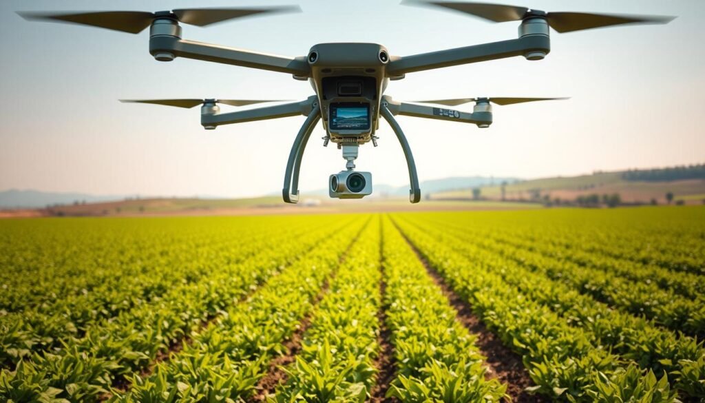
Drone mapping is crucial for precision agriculture. It generates 3D maps of farmland for soil analysis and drainage assessment. This data helps farmers allocate resources efficiently, reducing costs and waste.
Some drones have spraying systems for precise resource application. This optimizes use and minimizes environmental impact. Drone mapping supports sustainable farming practices.
| Drone Mapping Application | Benefits |
|---|---|
| Crop Health Monitoring | Early detection of pests and diseases, timely interventions to minimize crop losses |
| Precision Agriculture | Efficient allocation of resources (water, fertilizer, pesticides), reduced costs and waste |
| Livestock Monitoring | Aerial views of herds for health assessment and grazing management |
| Water Management | Identification of irrigation system issues and water stress in crops for efficient water use |
In environmental conservation, drone mapping aids vegetation management. It assesses coverage and health, guiding ecosystem protection and restoration. The UAE demonstrates the impact of drone mapping in environmental management.
Drone mapping addresses global food production challenges. It helps balance increasing food needs with environmental protection. This technology paves the way for sustainable agriculture and conservation efforts.
Drone Mapping Transforms Construction and Infrastructure Projects
Drone mapping is revolutionizing the construction industry. It enables efficient progress monitoring, site surveys, and improved safety. This technology has become essential for construction professionals.
Drones with advanced cameras survey large areas quickly. They gather accurate data, helping teams make informed decisions. Drone imagery provides up-to-date visual records of construction projects.
Progress Monitoring and Site Surveying
Drone mapping has changed how we monitor and survey construction projects. It covers vast areas faster than traditional methods. High-resolution images and 3D models offer a comprehensive site overview.
Ground control points ensure mapping data accuracy. This allows for precise measurements and high-quality digital surface models. Construction professionals can plan projects effectively using this reliable data.
Improved Safety and Efficiency in Construction
Drone mapping enhances safety on construction sites. Aerial inspections identify potential hazards, allowing teams to address them proactively. This creates a safer working environment for all personnel.
Detailed 3D models enable accurate planning and decision-making. Construction teams can optimize resource allocation and streamline workflows. Advanced mapping techniques provide valuable insights for data-driven decisions.
Drone technology’s impact on construction continues to grow. AI and machine learning integration will enable faster data analysis. This will help identify patterns and predict potential issues.
Drone mapping is transforming construction and infrastructure projects. It streamlines operations, enhances safety, and improves efficiency. As more companies adopt this technology, the industry will reach new levels of productivity.
Real Estate and Urban Planning Benefit from Drone Mapping Insights
Drone mapping is revolutionizing real estate and urban planning. It provides detailed 2D and 3D maps for property visualization and site analysis. These high-resolution aerial images offer valuable insights for professionals in both fields.
Real estate agents use drone mapping to showcase properties impressively. Orthomosaics and 3D models let buyers explore properties virtually. This technology also aids in land use planning, helping developers make smart decisions.
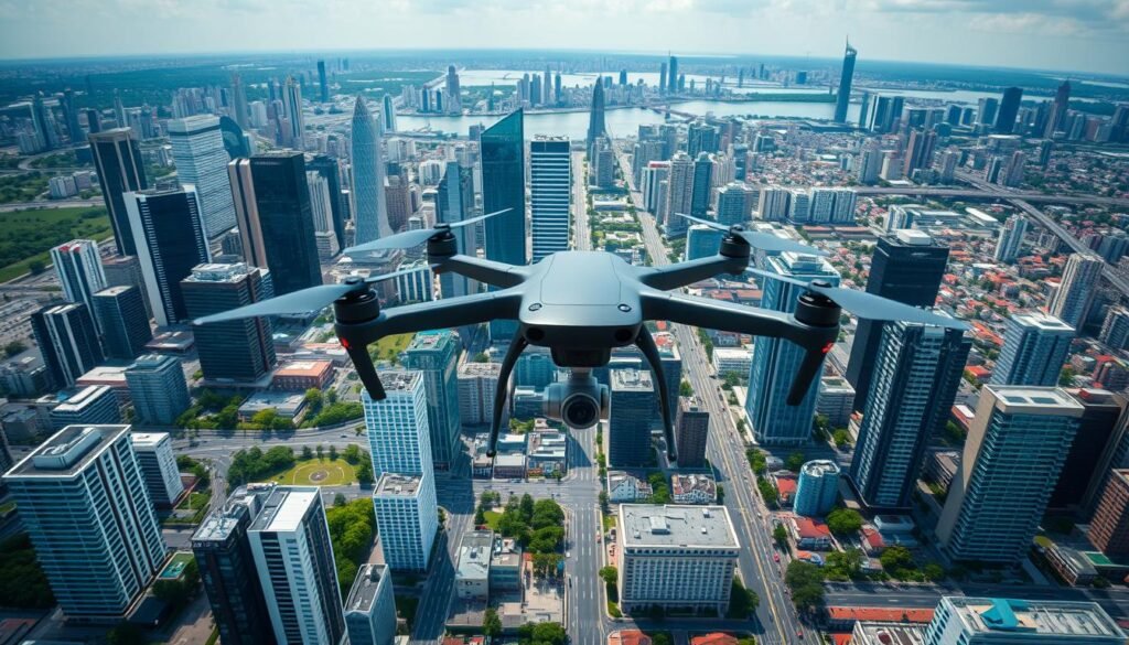
Urban planning relies heavily on drone mapping for cityscape modeling. Digital surface and terrain models offer a comprehensive view of built and natural landscapes. This data is crucial for designing sustainable cities that meet growing population needs.
“GIS is transforming the real estate development industry by providing a comprehensive view of different data types, helping professionals make informed decisions.”
GIS integration with drone mapping enhances real estate and urban planning capabilities. It analyzes factors like transportation routes, amenities, and environmental risks. This helps developers find ideal locations for new projects.
GIS also maps property values, housing demand, and population data. This gives professionals a deeper understanding of real estate markets. It enables them to make data-driven decisions with confidence.
| Drone Mapping Software | Key Features | Target Users |
|---|---|---|
| Autel Mapper | Advanced tools for high-precision 3D models and maps | Surveying and mapping professionals |
| DJI FlightHub 2 | Cloud-based platform for coordinating drone operations | Project managers overseeing multiple drone flights |
| DJI Terra | Transforms images into digital 3D models or maps | Construction, agriculture, or those requiring precise representations |
| PIX4Dmapper | Converts images from any drone into accurate maps and models | Professionals in need of photogrammetry solutions |
Drone mapping and GIS offer numerous benefits in real estate and urban planning. They enable informed decision-making and save time and money. These technologies also improve risk management and stakeholder communication.
As drone tech advances with AI and real-time processing, its impact will grow. It will continue to shape the future of real estate and urban planning significantly.
Drone Mapping Empowers Utilities and Energy Sector
Drone mapping technology is revolutionizing the utilities and energy sector. It uses high-resolution aerial imagery and advanced data processing. This technology streamlines operations, enhances safety, and improves efficiency.
Dronefly offers tailored drone mapping software for energy and utilities. Their products include DJI Terra, PIX4Dfields, and DroneDeploy. These options cater to utilities mapping, infrastructure inspection, vegetation management, and right-of-way monitoring.
Inspection and Maintenance of Critical Infrastructure
Drone mapping is crucial for inspecting and maintaining critical infrastructure. It captures high-resolution imagery and thermal data. This helps identify potential issues and plan proactive maintenance.
Pix4Dmatic excels in processing speed and scalability for large-scale inspections. It efficiently handles vast datasets. The software creates detailed 3D models and pinpoints areas needing attention.
Vegetation Management and Right-of-Way Monitoring
Drones are vital for vegetation management and right-of-way monitoring. They survey transmission lines and pipelines regularly. This helps detect encroaching vegetation and prevent potential hazards.
DJI Terra offers versatile mapping solutions for vegetation management tasks. It provides customizable flight planning and data capture options. This enables effective vegetation control and right-of-way monitoring.
| Software | Key Features | Ideal Applications |
|---|---|---|
| Pix4Dmatic | Exceptional processing speed and scalability | Large-scale energy infrastructure inspection |
| DJI Terra | Versatile mapping solutions, customizable flight planning | Vegetation management and right-of-way monitoring |
| Trendspek | Super-fast data processing, reducing render time | Efficient data management for utilities and energy projects |
Drone mapping technology enhances operations in the utilities and energy sector. The right software solutions improve safety and drive business growth. Companies can benefit greatly from embracing this innovative technology.
Choosing the Right Drone Mapping Software for Your Business
Businesses face many drone mapping software options. A thorough comparison helps select the best fit for your company’s needs. Consider processing speed, accuracy, and scalability when choosing.
Pix4Dmatic excels in processing large, high-resolution aerial mapping projects. Trendspek offers unmatched accuracy and fast render times for Precision Reality Twins. DJI Terra creates realistic 3D models with AI-optimized water surfaces.
Assessing Your Business Requirements
Evaluate your business needs before comparing software. Determine the types of maps and models you require. Consider the scale of your projects and your budget.
DJI Terra is suitable for terrain modeling, volumetric analysis, and vegetation mapping. It serves various industries with its AI technology and three resolution options.
Evaluating Ease of Use and Learning Curve
A user-friendly interface helps your team adopt the software quickly. Look for solutions with intuitive workflows and comprehensive training resources.
Trendspek offers a cloud-hosted collaborative workspace. This enhances teamwork efficiency and improves communication among global teams.
Considering Integration with Existing Workflows
Seamless workflow integration maximizes efficiency when implementing new software. Assess the software’s compatibility with your existing tools and processes.
Agisoft Metashape is known for its photogrammetric processing abilities. It generates accurate, detailed 3D models that integrate easily into various workflows.
Many providers offer flexible pricing plans. These include pay-as-you-go models, monthly subscriptions, and free trials. Choose an option that suits your company’s financial needs.
A thorough comparison of drone mapping software is crucial. Evaluate key factors like business needs, user-friendliness, and workflow integration. This helps you make an informed decision for success in drone mapping technology.
Conclusion
Drone mapping software has transformed how businesses collect and analyze geospatial data. It’s revolutionized industries like agriculture, construction, and urban planning. This technology enables informed decision-making and efficient operations, driving business growth and success.
Drone mapping offers numerous benefits, including cost and time efficiency. It also provides enhanced precision and detail in data collection. Drones with high-resolution cameras can quickly cover large areas, capturing detailed imagery and data.
Advanced software processes this data into accurate 3D models and orthomosaic maps. It also creates digital elevation models. These tools offer insights that were previously difficult or impossible to obtain.
As drone technology advances, its applications are rapidly expanding. Precision agriculture, crop monitoring, and infrastructure inspection are just a few examples. Businesses are finding innovative ways to use drone mapping to improve operations and stay competitive.
Investing in drone mapping software is a smart choice for forward-thinking businesses. It harnesses the power of aerial data to drive growth. By assessing needs and evaluating options, companies can find the right solution.
The right software helps efficiently capture, process, and analyze drone data. With clear benefits, now is the perfect time to embrace this transformative technology. It’s an opportunity to elevate your business to new heights.
