Professional Drone Photography Services for Any Project
Want to make your business stand out? Professional drone photography can help. It captures amazing aerial images that showcase your properties, products, and services like never before.
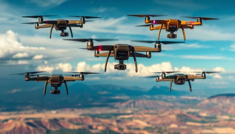
FlyGuys offers top-notch aerial photography and videography for various industries. Our FAA-certified pilots use cutting-edge drones with high-res cameras and GPS. We provide unique bird’s-eye views that make your business more engaging and memorable.
FlyGuys serves real estate, construction, hospitality, and other industries needing aerial imagery. We offer custom packages to fit your needs. Our services include high-quality photos, videos, virtual tours, and detailed inspections.
Key Takeaways:
- Professional drone photography services capture stunning aerial imagery for businesses
- Experienced and FAA-certified pilots ensure safe and high-quality results
- Customizable packages tailored to meet the specific needs of various industries
- Drone photography enhances visual appeal and engages target audiences
- Applications include real estate, construction, hospitality, and more
Capturing Stunning Aerial Imagery for Your Business
High-quality aerial imagery has become a powerful tool for businesses. It engages audiences and showcases products or services effectively. Drone photography offers a unique perspective, capturing stunning visuals that captivate viewers.
Professional drone shots provide high-resolution images at a lower cost. This makes them essential for many business marketing strategies. They leave a lasting impression on potential customers.
High-Quality Drone Photos and Videos
Our drone pilots use top-notch equipment from Parrot and Autel Robotics. They capture breathtaking aerial photos and videos for your business. Drone footage can increase viewer engagement by up to 20%.
It also improves website SEO by increasing dwell time. People remember 80% of what they see. This makes engaging visuals crucial for impressing your target audience.
Experienced and FAA-Certified Drone Pilots
Our FAA-certified drone pilots prioritize safety and compliance. They follow all Federal Aviation Administration regulations. Our team has extensive experience in aerial videography and photography.
We capture stunning visuals that tell your brand’s story effectively. Our pilots work closely with you to understand your vision. We deliver exceptional results for promotional videos, real estate listings, and event coverage.
Customizable Drone Photography Packages
We offer customizable drone photography packages for your specific project needs. Our services elevate your marketing efforts and engage your audience. We capture the beauty of golf courses and showcase unique features of properties.
Our packages include post-production editing for a polished final product. This ensures your content is ready to share across marketing channels.
Drone photography and videography can take your visual storytelling to new heights. Contact us to learn how we can capture stunning aerial imagery for your brand.
Elevating Real Estate Marketing with Drone Photography
Drone photography has transformed property showcasing. It offers a unique view that makes listings stand out. Real estate agents can boost interest by using real estate drone photography in their marketing plans.
Properties with aerial photos sell 68% faster than those without. Almost all homebuyers start their search online. Visual appeal is key in property listings.
Over a third of realtors use drones to market listings. This shows how popular the technique has become among professionals.
Showcasing Properties from a Unique Perspective
Aerial shots reveal property features hidden from ground level. This is great for large homes and vacant land. Drones capture the full scale and surroundings of a property.
Virtual Tours and Walkthroughs
Drone videos create immersive virtual property tours. Buyers can explore homes from anywhere. This helps out-of-town buyers or those who can’t visit in person.
Virtual tours highlight a property’s best features. They can create an emotional bond with viewers.
Highlighting Neighborhood Amenities and Surroundings
Drone photos show more than just the property. They capture nearby parks, schools, and shops. This gives buyers a feel for the area’s lifestyle.
Aerial views help agents appeal to specific buyer needs. They show the property’s broader context.
For real estate drone photography, work with FAA-certified pilots. Companies like VHT Studios offer professional drone services. They’ve photographed millions of rooms, aiding in billions of dollars in sales.
Quality aerial photos can boost marketing and speed up sales. Drones are becoming a key tool in real estate.
Drone prices range from $50 to over $10,000. There are options for all budgets. Some challenges remain, like regulations and hiring costs.
Yuneec offers drones for real estate photography. They feature 4K video and long flight times. Aerial imagery helps real estate pros make their listings shine.
Drone Videography for Immersive Storytelling
Drone videography has transformed storytelling, offering a unique aerial perspective. It’s now essential for event coverage and drone cinematography. Drones capture stunning footage that traditional methods can’t match.
FPV (First Person View) technology is an exciting development in drone videography. It allows high-speed maneuvers and flight through narrow spaces. This tech expands creative potential in aerial footage for both hobbyists and professionals.
Professional FPV drone videography delivers visually stunning results. It captivates audiences and caters to various creative needs. State-of-the-art equipment ensures top-tier videography with dynamic angles.
When seeking top UAV cinematography services, look for comprehensive solutions. These should cover filming and post-production. Skydio is known for advanced autonomous drones with excellent image quality.
| Benefit | Description |
|---|---|
| High-angle perspective | Provides a comprehensive view of locations, beneficial for industries such as real estate, construction, and urban planning |
| Cinematic quality | Enhances storytelling, making content more memorable and impactful, particularly useful for marketing and brand storytelling |
| Professionalism | Creates a sense of grandeur that captures viewers’ attention, setting content apart from standard ground footage |
| Immersive experience | Helps viewers feel part of the scene and builds a comprehensive understanding of the setting |
| Access to hard-to-reach places | Enables the viewing of facilities, sites, or events in their entirety from above |
FPV drone videography can boost your visual storytelling abilities. It offers a unique way to capture aerial footage. Businesses can use drones to create compelling stories that resonate with audiences.
drone photography services
Drone photography services offer top-notch aerial solutions for various industries. These services provide high-quality images and data for real estate, events, and commercial projects. They can take your project to new heights with stunning visuals.

Comprehensive Aerial Photography Solutions
Drone photography services cater to diverse project needs. They offer high-resolution photos, 4K videos, and advanced mapping services. These services can adapt to your unique project requirements.
From marketing photos to detailed orthomosaic imaging for surveys, they’ve got you covered. Their versatile capabilities ensure they can meet various project demands.
Tailored to Your Project’s Specific Needs
Each project is unique, so drone services offer customizable packages. They use top-notch drones like DJI models to suit your needs. You can choose shoot duration and deliverables for the best results.
| Service | Beginner | Intermediate | Expert |
|---|---|---|---|
| Drone Photography | $100 – $200 per hour | $200 – $350 per hour | $350 – $500 per hour |
| Drone Videography | $150 – $250 per hour | $250 – $400 per hour | $400 – $600 per hour |
| Drone Mapping and Surveying | $200 – $300 per hour | $300 – $450 per hour | $450 – $700 per hour |
Delivering High-Quality Results on Time
Professional drone services excel at delivering top-notch results on schedule. They employ FAA-certified pilots and use cutting-edge equipment. This ensures your project benefits from the best aerial photography and data collection.
Drone technology has revolutionized the way we capture and analyze data, offering unprecedented insights and perspectives for a wide range of industries.
Enhancing Golf Course Marketing and Maintenance
Drone photography services are revolutionizing golf course marketing and maintenance. These aerial images showcase unique beauty, complex layouts, and well-maintained grounds. This attracts new players and keeps existing members engaged.
Capturing the Beauty and Layout of Golf Courses
Drone photography offers stunning views of golf courses. It highlights hole intricacies and surrounding landscapes. High-quality aerial footage is a powerful marketing tool for attracting potential visitors.
Recent stats show a rise in drone technology for golf hole flyovers. Many courses use these visuals to boost online presence. They attract golfers through immersive virtual experiences.
Creating Digital Yardage Books and Maps
Drone surveying creates detailed digital yardage books and maps. These resources provide comprehensive hole information, including distances, hazards, and optimal strategies. Digital tools enhance player experience and aid in decision-making.
Benefits of digital yardage books and maps include:
- Accurate distance measurements for improved club selection
- Detailed illustrations of hazards and obstacles
- Flyover videos showcasing the layout and challenges of each hole
- Integration with mobile apps for easy access during play
Assisting with Course Maintenance and Planning
Drones play a crucial role in golf course upkeep and planning. Aerial inspections quickly spot areas needing attention, like irrigation issues or turf damage. High-resolution images help maintenance teams make informed decisions and allocate resources effectively.
Drone mapping aids architects in optimizing layouts during renovations or new projects. It provides valuable data for course improvements and design decisions.
| Benefit | Description |
|---|---|
| Efficient maintenance | Identify areas needing attention quickly |
| Improved turf health | Monitor irrigation, disease, and pest issues |
| Informed decision-making | Provide accurate data for course improvements |
| Enhanced safety | Identify potential hazards and plan emergency routes |
Drone photography and surveying services boost golf course marketing and player experiences. They also optimize maintenance processes. Our FAA-certified drone pilots capture golf course beauty and complexity.
We help courses stand out in the competitive golfing industry. Our aerial imagery solutions elevate marketing efforts and enhance overall operations.
Drones in the Hospitality and Tourism Industry
Drones are revolutionizing the hospitality and tourism industry. They capture stunning aerial footage of hotels, resorts, and destinations. This enhances guest experiences and improves operational efficiency.

Hotels and resorts use drones to showcase their properties beautifully. Aerial videography highlights unique features, amenities, and surrounding landscapes. This helps potential guests make informed decisions when booking their stay.
Showcasing Hotels, Resorts, and Destinations
Drones have become crucial for showcasing hospitality properties. They offer a competitive advantage in the industry. Major hotel chains like Marriott, Hilton, Four Seasons, and Sandals now use drones in their marketing.
| Benefit | Description |
|---|---|
| Improved Visual Appeal | Aerial drone virtual tours capture the entire set-up, scale, configuration, and situation of the property |
| Increased Accessibility | Users can explore properties, tourist attractions, or event venues from anywhere |
| Time and Cost-Efficient | Drones are more efficient compared to traditional methods of capturing virtual tours |
| Versatility | Drones can easily access high buildings, rugged terrains, and large outdoor spaces |
Creating Compelling Promotional Videos
Hospitality brands use drones for innovative marketing strategies. Aerial videography captures dynamic views of properties. This enhances social media content and attracts potential guests.
Studies show that drone footage increases online engagement. It attracts attention to hospitality products and services.
Proper training and certification are essential for operating drones effectively and safely in the hospitality industry, ensuring compliance with local regulations, privacy laws, and airspace restrictions to protect guest information and maintain legal operations.
Drones help create compelling content for the hospitality industry. They showcase the beauty and unique experiences of properties. This attracts more guests and boosts business.
Construction Site Monitoring and Progress Tracking
Drones have changed how we monitor construction sites. They provide regular aerial inspections to spot issues and safety concerns. These inspections create detailed progress reports with high-quality images and videos.
This helps stakeholders stay informed and support project management. It also ensures that safety rules are followed on site.
Our drone inspections are vital for construction companies. We can cover up to 300 acres per day using LiDAR technology. Our accuracy is up to 3cm, using survey-grade GNSS equipment.
We can be on-site within 5-7 business days after first contact. Project delivery takes 2-5 business days after completion.
Regular Aerial Inspections and Updates
Frequent drone inspections improve project timelines. They allow real-time progress tracking and quick problem-solving. Our services have helped clients monitor:
- 1.9 million square feet of warehouse space
- 100,000+ square feet of retail space
- Over 2 years of partnership with FCL Builders Northeast division
Identifying Potential Issues and Safety Concerns
Drones use advanced tech to capture high-quality data. This includes photos, videos, thermal, and topographical information. The data helps create precise site maps and check structural integrity.
This method reduces safety risks. It avoids time-consuming ground inspections in dangerous areas. Worker safety is improved during data collection.
Generating Detailed Progress Reports
Our drone inspections give managers a full view of the site. This allows for better monitoring than traditional physical inspections. Detailed cut and fill reports boost efficiency in earthwork projects.
Aerial imagery helps keep projects on schedule. It provides accurate, real-time data to spot potential delays early. This prevents issues from affecting project milestones.
| Benefit | Aerial Imagery | Traditional Monitoring |
|---|---|---|
| Data Accuracy | High | Moderate |
| Worker Safety | Minimal Risk | Potential Hazards |
| Time Efficiency | Improved | Time-Consuming |
Aerial imagery offers many benefits for construction projects. It improves decision-making, communication, and cost savings. It also increases safety by reducing worker exposure to hazards.
The construction industry is using more aerial imagery for progress tracking. Drone inspection services are becoming crucial for successful project management.
Drone Inspections for Infrastructure and Utilities
Drone inspections have transformed how companies assess and maintain their assets. UAVs with advanced cameras offer a safe, cost-effective solution for visual inspections. These unmanned vehicles can access hard-to-reach areas, eliminating risks for human inspectors.
Drones capture high-resolution images and videos for detailed analysis. They can identify potential issues, defects, or damage in structures. This technology provides valuable data for maintaining infrastructure integrity.
Drone inspections offer numerous benefits. They can survey over 600 acres in a single day, saving time and money. Some drones use thermal imaging to detect heat signatures.
This technology helps identify performance issues in solar farms. It can also locate leaks in pipelines, enhancing maintenance efficiency.
Drone inspections are used across various industries:
- Oil and gas: Drones assist in finding new drilling sites, analyzing reservoirs, and detecting structural defects in pipelines, storage tanks, and offshore platforms.
- Energy: Drones are employed to inspect wind turbines, solar panels, and power lines, maximizing efficiency and minimizing downtime.
- Utilities: Drones help assess the condition of water towers, substations, and transmission lines, enabling proactive maintenance and reducing the risk of failures.
- Construction: Drones monitor progress, ensure compliance with safety regulations, and provide valuable data for project management.
The drone inspection market is growing rapidly. Experts predict it will reach $18.94 billion by 2028. Drones are becoming more advanced, with longer flight times and better cameras.
Popular models for inspection services include:
| Drone Model | Range | Flight Time |
|---|---|---|
| DJI Air 2S | 7.5 miles | 31 minutes |
| DJI Mavic 3 | 9.3 miles | 46 minutes |
| DJI Matrice 30T | 4.34 miles | 41 minutes |
When selecting a drone for inspections, consider range, camera quality, and flight time. Gimbal stabilization and payload capacity are also important factors. These features ensure optimal performance and accurate data collection.
Drone inspections are not just about capturing images; they’re about providing actionable insights that help companies make informed decisions and maintain the integrity of their assets.
Drone inspection technology is becoming crucial for infrastructure and utilities. It ensures safety, efficiency, and reliability in various industries. As demand grows, drones will play an increasingly important role in asset management.
Conclusion
Drone photography has transformed industries, offering benefits that traditional methods can’t match. It enhances projects in real estate, construction, agriculture, and environmental monitoring. Aerial photography provides unique perspectives, detailed imagery, and valuable data for better decision-making.
Drone surveys are up to 80% faster than traditional methods. A 10-day, $10,000 survey can be done in 2 days for $2,000. Drones cover large areas quickly, collecting data with fewer workers while maintaining accuracy.
In real estate, drone photography is a game-changer. Aerial shots showcase properties comprehensively, attracting more buyers and speeding up sales. It highlights a property’s size, design, and surroundings, creating a competitive advantage.
Professional-grade drones produce high-quality 4K images and videos. This enhances brand identity and marketing strategies across various industries. The versatility of drones is expanding their applications rapidly.
Drones aid in crop management, construction inspections, and environmental conservation. They improve efficiency, safety, and quality in many fields. As businesses recognize the potential of aerial photography, demand for professional drone services continues to grow.